

If you live near Lake Erie, Lake Ontario, or any of the Great Lakes, you’ve probably watched two towns ten miles apart get completely different winters one buried under three feet of snow, the other barely seeing a flurry. That’s lake effect snow in action, and once you understand how it works, those wild local differences finally make sense. This guide breaks down the real science behind it, without the jargon, plus what it actually means for your commute, your kids’ school schedule, and your safety.
What Is Lake Effect Snow and How Does It Form?
Lake effect snow happens when cold, dry air moves across a much warmer lake surface. As that cold air travels over the water, it picks up heat and moisture from the lake below. The warmed, moisture-loaded air becomes lighter than the frigid air above it, so it rises. As it rises, it cools again, and that moisture condenses into clouds, clouds that can dump snow at rates of two to three inches per hour, sometimes more, once they reach land.
This process is different from a typical winter storm, which usually comes from a large frontal system covering hundreds of miles. It’s hyper-local instead, forming in narrow bands often just a few miles wide, which is exactly why one neighborhood gets buried while the next one over stays dry.
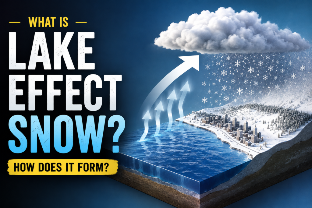
The Simple Physics Behind It
The whole process comes down to one basic fact: water holds heat far longer than air does. In late fall and early winter, the Great Lakes are still relatively warm from summer, while the air above them turns bitterly cold sometimes flowing straight down from Canada. That temperature gap is the engine driving the entire event. The bigger the gap between water temperature and air temperature, the more intense the snowfall tends to be.
What Causes Lake Effect Snow to Be So Unpredictable?
One of the most common questions people ask is simple: what causes lake effect snow to be so hard to forecast, even with modern radar and weather models? The answer lies in how narrow and sensitive these snow bands really are.
Wind direction is the biggest factor. A shift of just five or ten degrees can move an entire snow band miles away from where it was expected, sparing one town while burying another. Meteorologists can usually tell you when conditions are ripe for lake effect snow. What they struggle to pin down is exactly where the heaviest band will set up and how long it will sit there, since even a small wind shift can send it drifting to a completely different stretch of shoreline.
Wind speed and fetch (the distance the air travels over open water) also matter. A longer path across the lake means more time for the air to absorb moisture, which usually means heavier snowfall once that air reaches land. Add in local geography such as hills, valleys, and shoreline shape, and you get pockets that consistently see more snow than areas just a short drive away, year after year. This unpredictability is exactly why lake effect snow forecasts often include phrases like “localized totals could vary significantly,” rather than a single confident number for an entire region.
Snow Belt Cities: Where Lake Effect Snow Hits Hardest
Certain snow belt cities deal with this phenomenon so often that it shapes local culture, school calendars, and even how homes are built. Buffalo, New York is probably the most famous example, sitting directly downwind of Lake Erie and regularly catching multi foot snow bands each winter. Syracuse and Watertown, further east, sit in the path of Lake Ontario’s moisture and consistently rank among the snowiest cities in the country.
On the western side of the Great Lakes, places like South Bend, Indiana and Grand Rapids, Michigan get hit by bands rolling off Lake Michigan, while Erie, Pennsylvania and Cleveland, Ohio deal with Lake Erie’s effects from a different angle. Up in Ontario, Canada, towns along the eastern shore of Georgian Bay and areas near Owen Sound see similar bursts, since the same lake driven mechanics apply north of the border too.
What makes these snow belt cities unique isn’t just total snowfall. It’s how localized the impact is. A resident on one side of Buffalo might shovel three feet of snow while a coworker fifteen minutes away never touches a shovel all week. Long time residents in these areas often track wind direction almost like a hobby, because it tells them more about their personal snow forecast than any general weather report does.
When Does Lake Effect Snow Season Start and End?
Lake effect snow season typically kicks off in late November and runs through February, though the exact timing shifts a bit depending on the year. The season starts once air temperatures drop well below freezing while the Great Lakes are still unfrozen and holding onto their summer and fall warmth. That gap between cold air and warm water is what gets the whole process going.
As winter progresses, something interesting happens: the lakes themselves start to cool down. Once ice begins forming on the surface, especially on shallower lakes like Erie, the open water that fuels evaporation and heat transfer shrinks. Less open water means less fuel for snow bands, which is why lake effect events tend to taper off significantly by late February or March even if the region is still plenty cold.
This is also why the heaviest, most dramatic snow bands often show up early in the season, sometimes as soon as mid to late November, before the lakes have had a chance to cool and ice over. A cold snap arriving in November, when the lake water is still relatively mild, can produce far more intense snowfall than the same temperature drop would in January.

Staying Safe: Driving and Preparing for Lake Effect Snow
Because lake effect bands can form and intensify quickly, safety matters more here than with a typical, slower moving winter storm. A road can go from clear to whiteout conditions in a matter of minutes if a snow band shifts overhead.
If you’re driving in a snow belt region during winter, keep a few things in mind:
- Slow down well before you expect reduced visibility, not after you’re already in it. Snow bands can drop visibility to near zero without much warning.
- Keep extra distance from other vehicles, since stopping distances on lake effect snow can be far longer than they appear.
- Carry an emergency kit in your car, including a blanket, flashlight, and phone charger, in case you get stuck waiting out a band.
- Check local road condition reports before long drives, since conditions a few miles apart can be completely different.
- If visibility drops sharply while driving, pull off safely rather than trying to push through it.
Local emergency services in cities like Buffalo and Syracuse routinely issue travel advisories during intense band events, and it’s worth taking those seriously even if the sky looks clear when you start your trip.
Lake Effect Snow and Snow Days: Can You Predict a Closure?
This is where a lot of parents and students land on this topic. Because lake effect snow is so localized, using a generic snow day calculator or snow day predictor in these regions comes with a catch worth understanding.
Most snow day prediction tools rely on factors like total forecasted snowfall, wind chill, and historical closure patterns for your zip code. That works reasonably well for storms that blanket an entire region evenly. Lake effect snow doesn’t play by those rules. A snow predictor might show your area getting six inches, while the actual snow band sets up two miles away and drops eighteen inches instead, or shifts entirely and leaves your street nearly bare.
That doesn’t mean these tools are useless. A snow day calc is still a solid starting point, especially for gauging general storm severity and timing. But in snow belt cities, school officials also lean heavily on real time factors that no calculator can fully capture: overnight band positioning, road treatment crew reports, and morning visibility on specific routes. This is why closure decisions in places like Buffalo or Syracuse sometimes come down to the wire, often announced at 5 or 6 a.m., rather than the night before. If you’re relying on a prediction tool during lake effect season, treat it as a rough guide rather than a guarantee, and pair it with a quick check of your local radar and any active weather advisories before heading out the door.
Is Lake Effect Snow Changing With the Climate?
There’s growing evidence that lake effect snow events are intensifying in some areas, not fading away. As the Great Lakes take longer to freeze over each winter, due to gradually warming water temperatures, the window for lake effect snow production stays open longer. Warmer air also holds more moisture, which can translate into heavier snowfall totals when conditions do line up. That trend doesn’t mean every winter will bring more snow than the last. Year to year variation is still huge. But the underlying pattern, warmer lakes staying open later into the season, is something meteorologists in snow belt regions are watching closely.
FAQs
What is lake effect snow in simple terms?
It’s snow that forms when cold air passes over a much warmer lake, picks up moisture, and dumps it as heavy, localized snowfall once it reaches land downwind.
Why does lake effect snow only hit certain towns and not others nearby?
Because snow bands are narrow, often just a few miles wide, small shifts in wind direction can move the entire band away from one town and directly over another.
Which cities get the most lake effect snow?
Buffalo, Syracuse, and Watertown in New York, along with Erie, Pennsylvania and South Bend, Indiana, are among the snow belt cities that see the heaviest and most frequent lake effect events.
Does lake effect snow stop once a lake freezes over?
Mostly, yes. Once ice covers the lake surface, there’s far less open water to fuel evaporation, so snow production drops off significantly, even if it’s still bitterly cold outside.
Can a snow day calculator accurately predict closures during lake effect snow?
Not reliably. A snow day predictor works better for storms that cover a wide, even area. Lake effect snow is too localized for most tools to capture, so schools often rely on real time road and visibility reports instead.